Geospatial cloud made
fast & accessible
Forget about architecture maintenance, and boost your team’s productivity with Maphub.co
Introducing Maphub.co:
the Geospatial Cloud for collaboration
Store all your geospatial datasets in the cloud, and access it through the browser, or directly from QGIS. Increase sharability, boost your team’s productivity, and uncover insights as a team.
Features
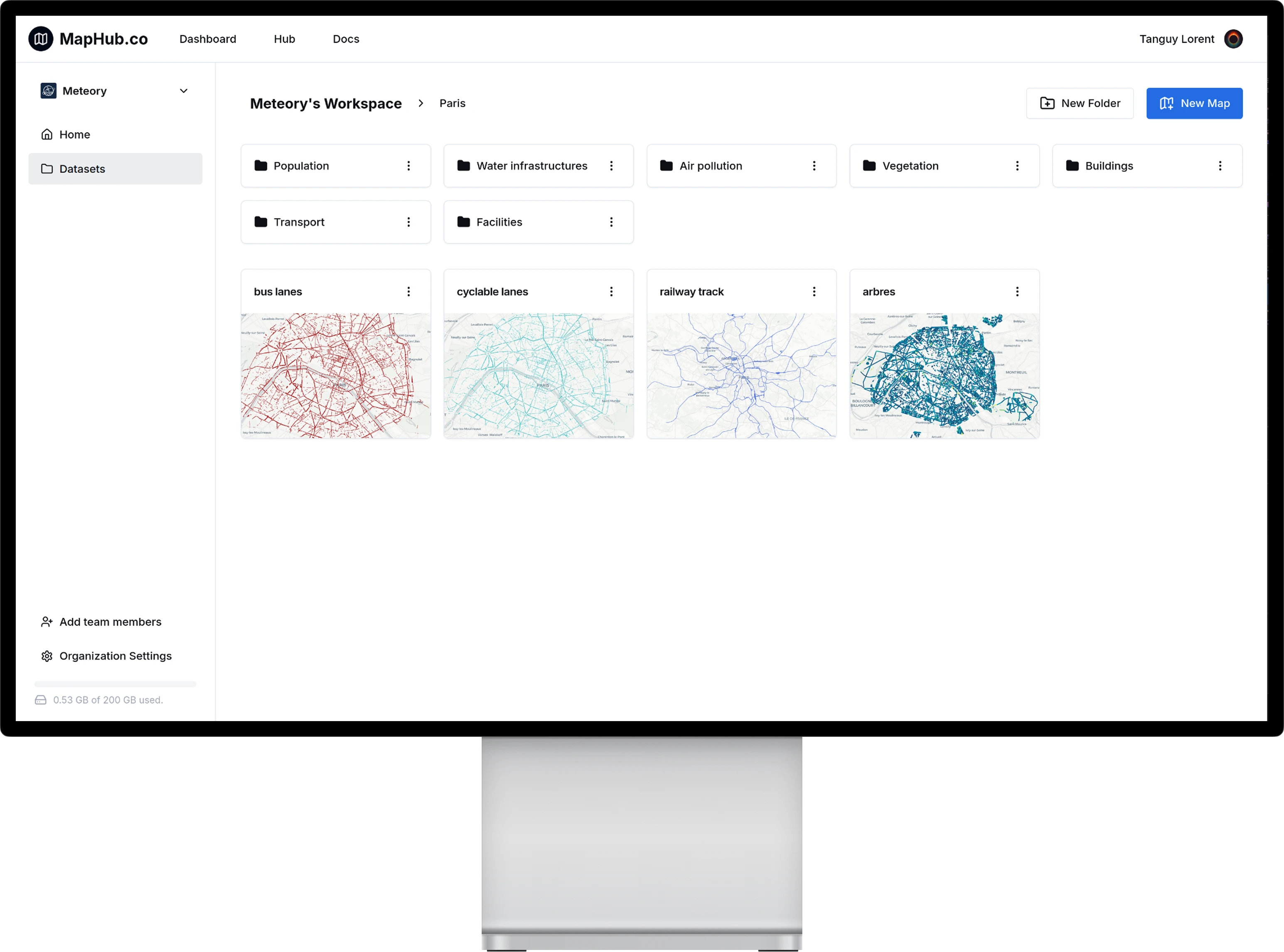
Build your geospatial catalog
Transform your geospatial data into a cloud catalog that can be accessed anywhere, anytime.
Share
Embed into your own website, send a Tiling URL, or just share the link to your map.
Collaborate
Create your organization, invite your team, manage access and start collaborating on your projects.
Integrate into your workflow
Between our QGIS plugin, python package, CLI, API or even MCP, choose the solution that suits the best your workflow.
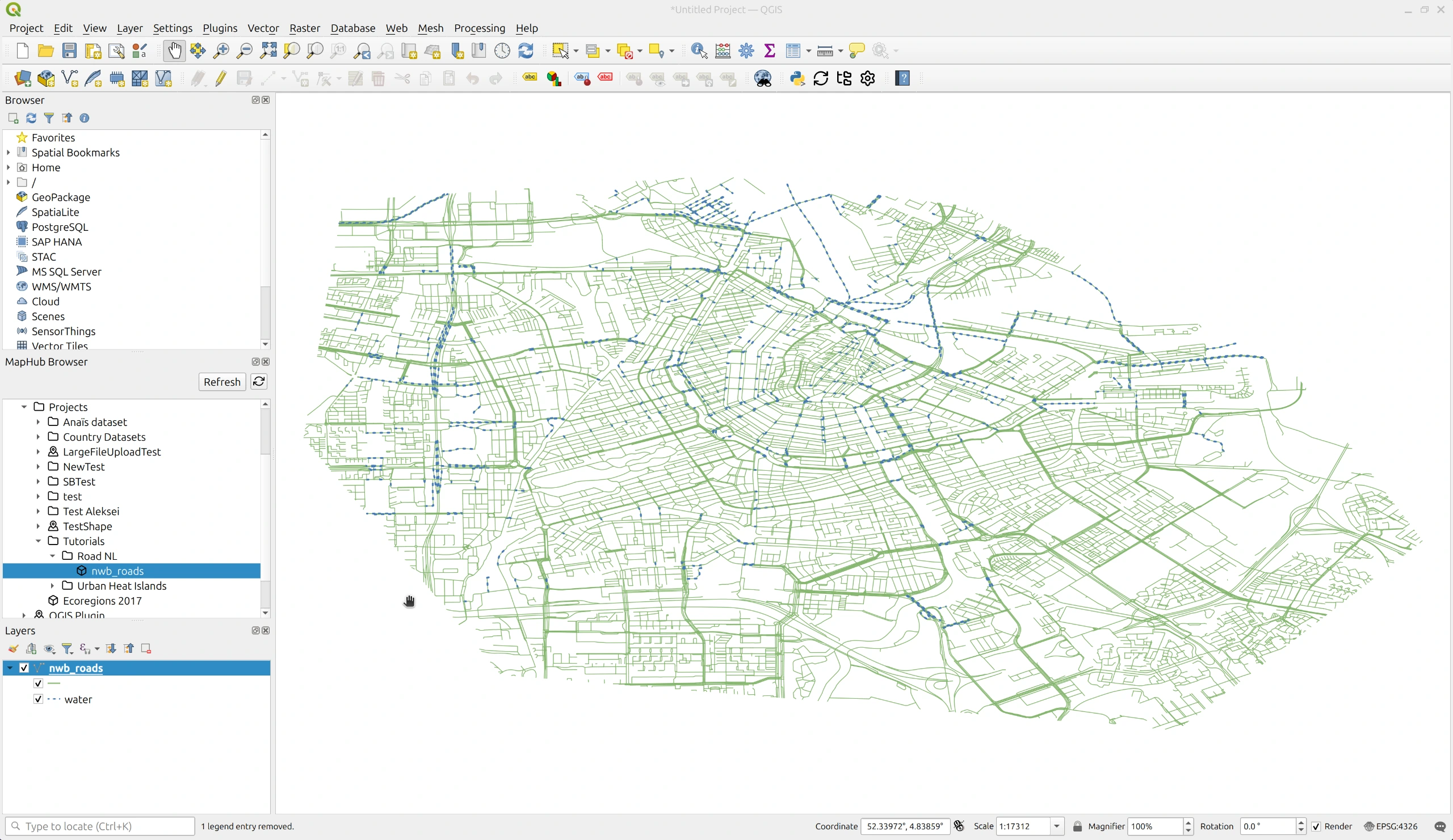
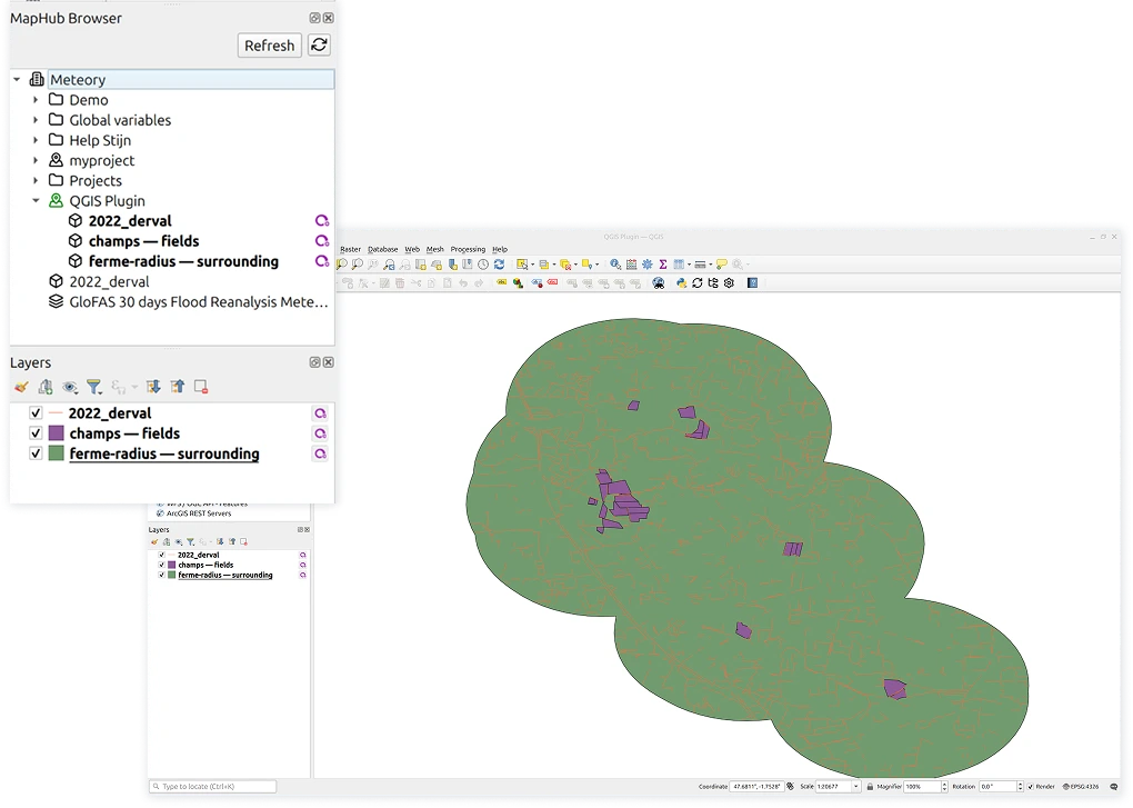
Organise
Easily manage your geospatial data through a Drive like interface.
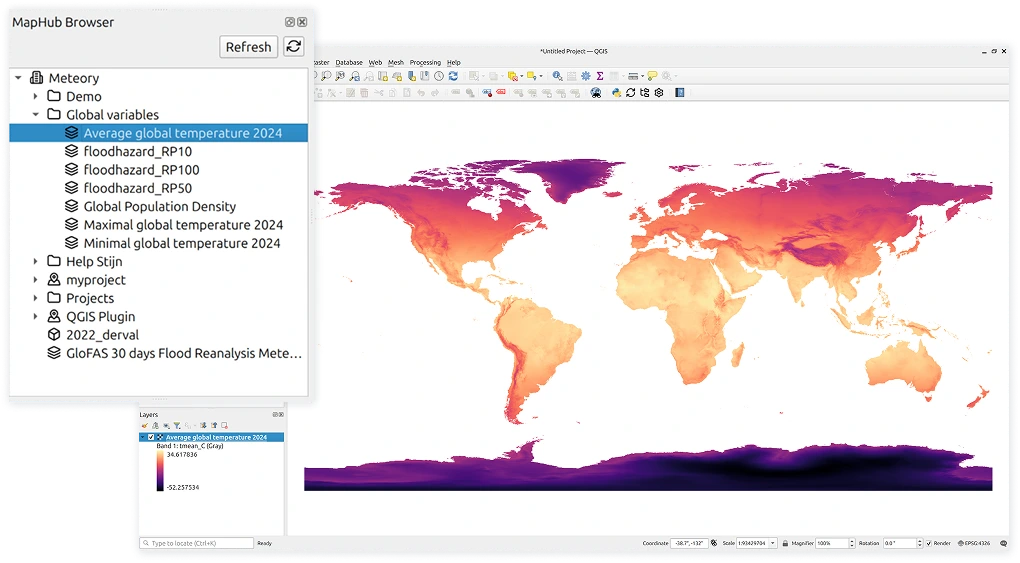
Preview
Visualize your data directly inside the browser.
Interact with data
Filter, style, analyse and interact with your data using kepler.gl.
Universal Format Support
Shapefiles, GeoJSON, TIFFs – you name it. Maphub support all major geospatial formats.
Integrate
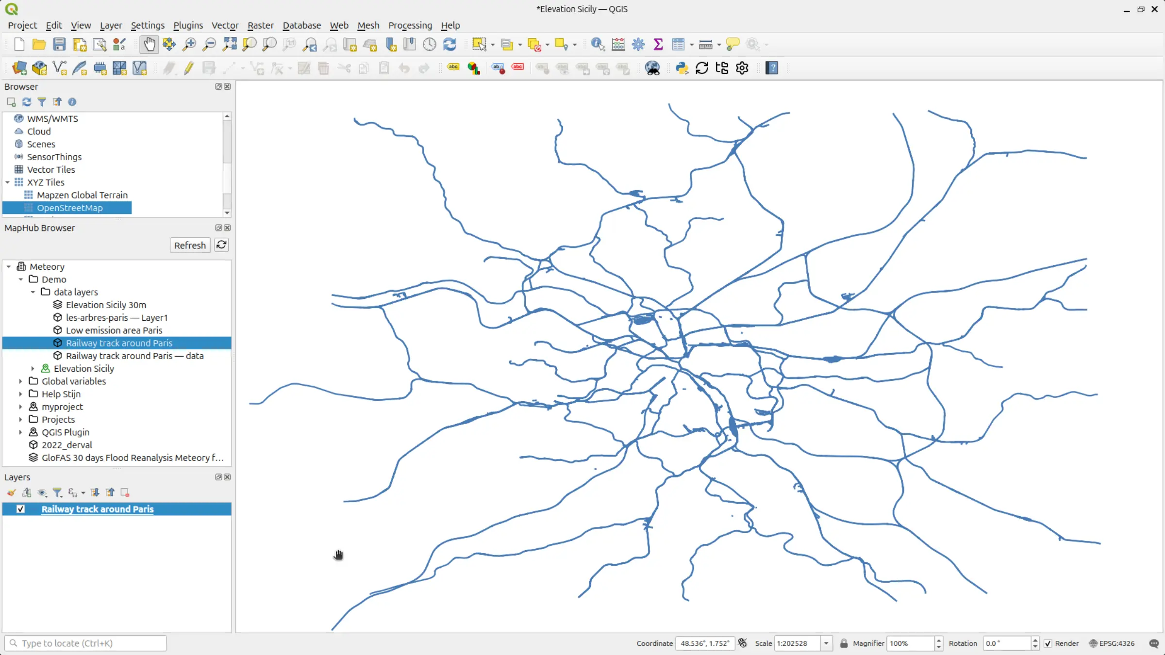
Seamlessly integrate with QGIS
Simply drag and drop your files from Maphub browser, import other datasets, extract, combine, and save the result into the cloud, without leaving QGIS.
Download the QGIS plugin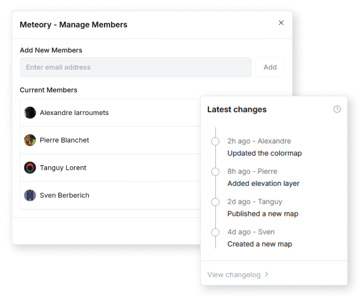
Collaborate
Boost your team workflow
MapHub offers a shared and secure workspace where you and your team can easily access, upload, and visualize geospatial datasets. Make the data fly from one stakeholder to the other.
Start collaborating now !Optimize
Forget about long file transferts
Maphub automatically uses cloud optimized geospatial format like PMTiles and COG by default. Forget about conversions and long file transfers, we handle everything for you.
Get started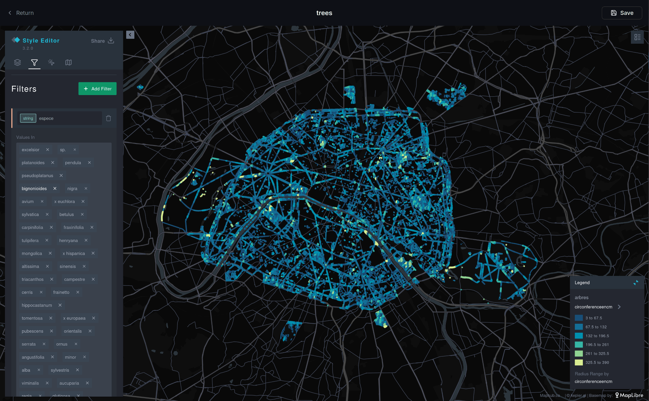
Visualize
Access and preview spatial data directly in the browser
Get a quick visualization, or go deeper in the analysis directly in the browser. Easily style you dataset, get a beautiful visualization and share the result with your team or clients.
Try nowPlans & Pricing
Get cloud storage and unlimited access to Maphub tools for you and your team.
Explorer
Includes
- 3Gb of cloud storage
- QGIS plugin integration
- Limited access to tools
Plus
Everything in Explorer, plus:
- 15Gb of cloud storage
- Unlimited access to tools
- Teams (unlimited seats)
- Member access management
Tools included
- • Scan my GIS file
- • 1 click PostGIS
- • Geo cloud converter
- • GeoSpot
Professional
Everything in Plus, plus:
- 50Gb of cloud storage
- Role-based access control
- Centralized billing
- Priority customer support
Business
Everything in Pro, plus:
- Custom cloud storage
- Custom pricing
- Flexible payment options
- Dedicated customer support
Interested but still not sure?
Contact us for a demo !
Subscribe to our newsletter !
Receive our last product updates and community news directly in your inbox.