A Practical Guide to Geospatial Data Formats - What to Use and When
In this article, we'll demystify the most common geospatial data formats, explain when to use each.
Why MapHub Exists
Geospatial data is the invisible backbone of our digital maps, navigation systems, and countless research projects. But if you've ever tried to share, analyze, or visualize this data, you've likely run into a maze of file formats-each with its own quirks, strengths, and limitations. Understanding these formats is crucial for anyone working with maps, whether you're a GIS professional, a researcher, or simply a curious explorer.
In this article, we'll demystify the most common geospatial data formats, explain when to use each, and offer guidance for making your mapping workflow as smooth as possible.
Vector vs. Raster: The Foundation of Geospatial Data
At the heart of geospatial data are two fundamental types: vector and raster. Vector data represents the world using points, lines, and polygons-think of a city's road network, property boundaries, or hiking trails. Raster data, on the other hand, is made up of a grid of pixels, much like a digital photograph. This is the go-to format for satellite imagery, elevation models, and anything that changes continuously across a landscape.
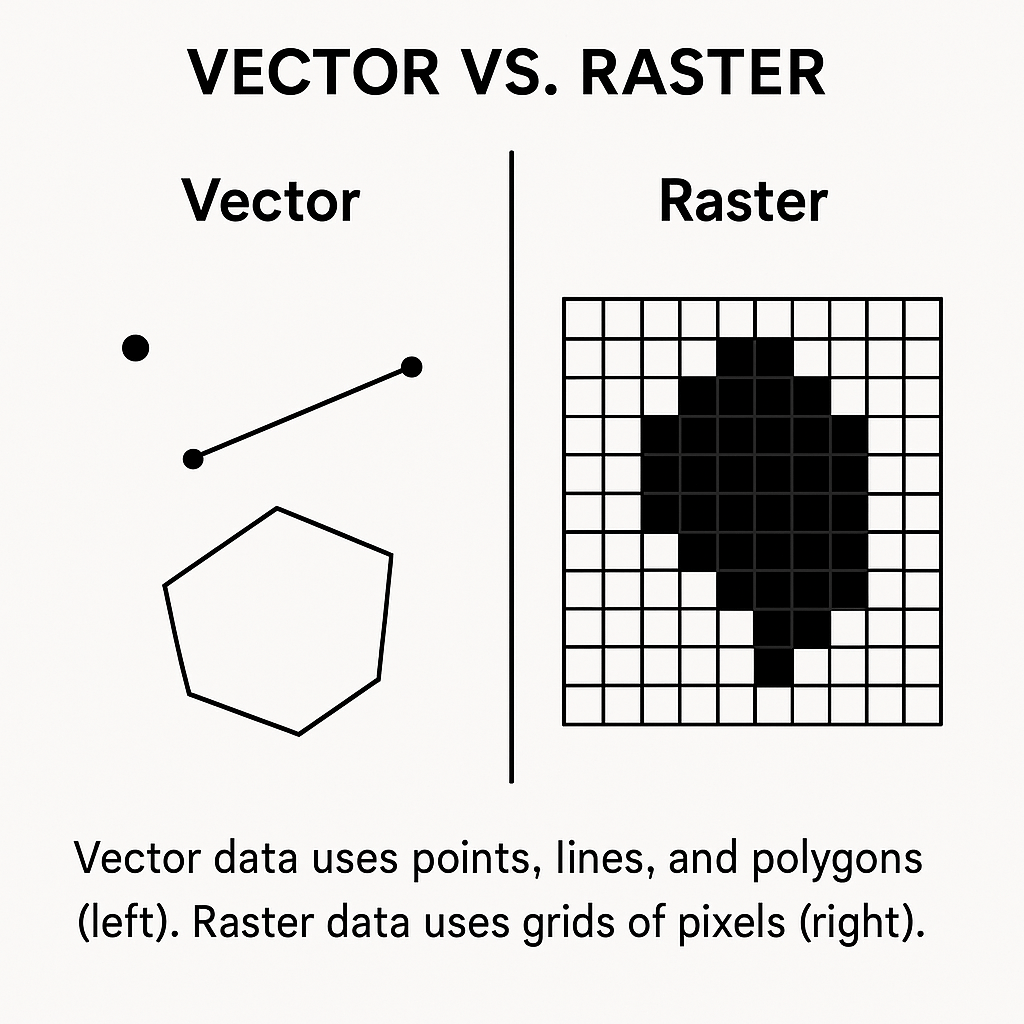
Choosing between vector and raster isn't just a technical decision-it's about matching your data to the story you want to tell. If you're mapping the outline of a lake, vector is ideal. If you're analyzing temperature changes across a region, raster is your friend.
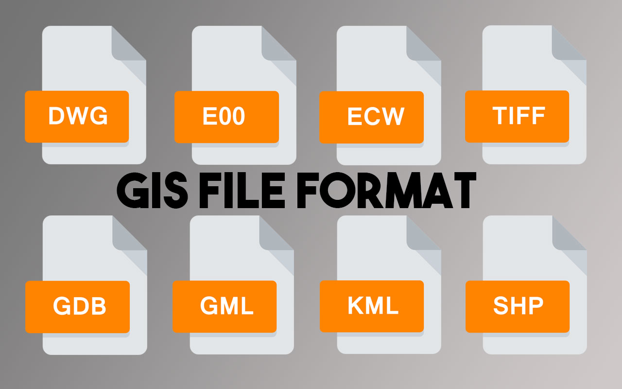
The Most Popular Geospatial Data Formats
Let's take a closer look at the file formats you're most likely to encounter-and when you should reach for each one.
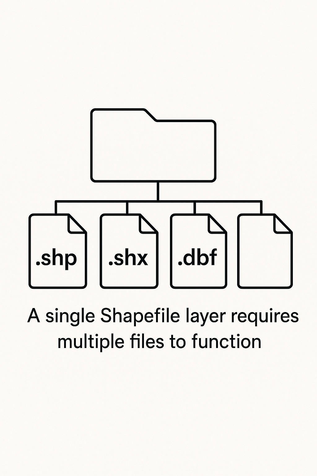
Shapefile (.shp)
The Shapefile is a true GIS classic. Developed in the 1990s, it's still one of the most widely used formats for vector data. Shapefiles are supported by virtually every GIS platform, making them a safe choice for sharing data. However, they come with baggage: a single Shapefile is actually a collection of several files (.shp, .shx, .dbf, and sometimes others), and they're limited to 2GB in size. Shapefiles also struggle with complex data types and don't support modern features like time or 3D data.
If you're working with legacy systems or need maximum compatibility, Shapefiles are a solid bet. But for new projects, you might want to consider more modern alternatives.
GeoJSON (.geojson)
GeoJSON is the darling of web mapping. Based on the ubiquitous JSON format, it's easy to read, write, and share-especially for developers. GeoJSON files are perfect for lightweight datasets and integrate seamlessly with JavaScript mapping libraries like Leaflet and Mapbox. Their human-readable structure also makes debugging a breeze.
However, GeoJSON isn't ideal for very large datasets, as file sizes can balloon and performance may suffer. If your project is web-based or you need to quickly share spatial data over the internet, GeoJSON is hard to beat.
GeoTIFF (.tif)
When it comes to raster data, GeoTIFF is the gold standard. This format embeds spatial metadata directly into the image file, ensuring that your data knows exactly where it belongs on the Earth's surface. GeoTIFFs are widely used for satellite imagery, aerial photography, and digital elevation models. They support multiple bands (for things like infrared or multispectral imagery) and can be compressed to save space.
The main downside? GeoTIFF files can be massive-especially at high resolutions. But for scientific analysis and remote sensing, they're indispensable.
GeoPackage (.gpkg)
GeoPackage is a modern, open-source alternative that aims to solve many of the problems of older formats. It stores vector and raster data in a single, compact SQLite database file. This means you can keep all your layers, attributes, and even styling information together, without juggling multiple files.
GeoPackage supports spatial indexing for fast queries and has no practical file size limits. While not as universally supported as Shapefile (yet), it's quickly becoming the go-to choice for complex or large-scale projects.
KML/KMZ (.kml/.kmz)
Originally developed for Google Earth, KML (and its compressed sibling, KMZ) is designed for easy sharing and visualization. KML supports 3D features, time-based animations, and rich styling, making it a favorite for storytelling and public-facing maps. However, it's less suited for heavy-duty analysis or datasets with complex attributes.
If you want to create an interactive tour or share a map with a broad audience, KML is a great choice.
How to Choose the Right Format
With so many options, how do you decide which format to use? Start by asking yourself a few key questions:
- What type of data am I working with? (Vector or raster?)
- How large is my dataset? (Some formats have size limits.)
- Who needs to use this data? (Consider compatibility with their tools.)
- Will this data be used on the web, in analysis software, or for visualization?
Here's a quick reference to help you decide:
| Use Case | Recommended Format |
|---|---|
| Web mapping | GeoJSON, Vector Tiles |
| Satellite imagery storage | GeoTIFF |
| Multi-layer project | GeoPackage |
| Sharing with non-GIS users | KML |
| Legacy system integration | Shapefile |
Emerging Formats and the Future of Geospatial Data
The world of geospatial data is always evolving. New formats like FlatGeobuf (for fast streaming of large vector data) and Cloud-Optimized GeoTIFF (COG) are gaining traction, especially as cloud computing and big data become more central to GIS workflows. Meanwhile, open standards and interoperability are more important than ever, as organizations strive to break down data silos and foster collaboration.
Conclusion: Simplifying Geospatial Data with MapHub
Navigating the maze of geospatial file formats can be daunting, but choosing the right one is key to a successful project. Whether you're building a web map, analyzing satellite imagery, or collaborating with a team, understanding your options will save you time and headaches.
Of course, managing all these formats doesn't have to be a chore. At MapHub, we take the pain out of geospatial data management. You can upload virtually any geospatial file-Shapefile, GeoJSON, GeoTIFF, GeoPackage, and more-and MapHub will automatically process and optimize it for easy sharing and visualization. No more worrying about compatibility or conversion: just focus on your map, and let us handle the rest.
Ready to make your geospatial workflow simpler? Try MapHub today.
References and further reading: