Geospatial cloud made
easy, fast & scalable
Free yourself from postgis and postgres database. Seamlessly collaborate with your team on GIS projects with MapHub.co Cloud.
MapHub uses PMTiles to offer you a blazing performance
Forget about format compatibility, we handle it for you
For a fully managed platform to host, collaborate and share spatial data
Free yourself from chaos
Waste less time handling formats compatibility
Access all your spatial files, collaborate, analyse, and deliver value on one blazing fast platform. Upload your data directly from workflow, and seamlessly import it anywhere else. Maphub simply make geospatial data cross compatible.
Trusted by
Geospatial Cloud
Access your geospatial data at any time, from anywhere, thanks to the cloud
MapHub is a specialized cloud solution that enables GIS teams to easily host any spatial file, and create their own catalog.
It handles all geospatial formats and converts it into cloud optimized files, to deliver it as raster tiles or vector tiles.
Maphub cloud is the one place for companies to host and serve geospatial data, fast and safely.
Collaboration
Easily collaborate with your team on GIS project
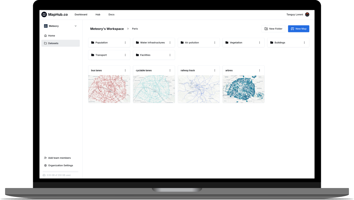
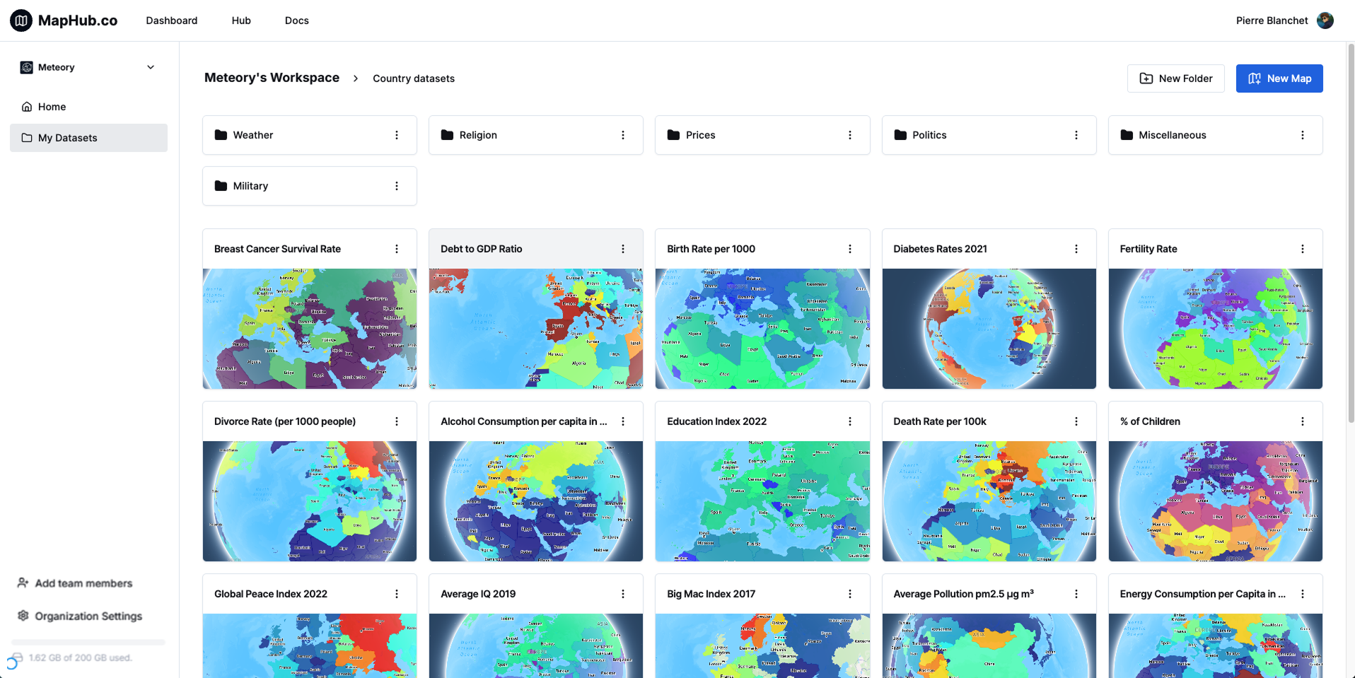
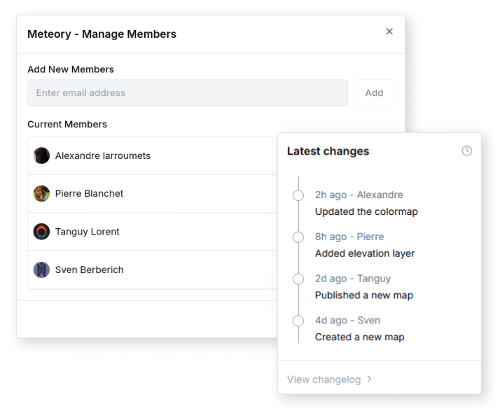
MapHub offers your team a shared and secure workspace where they can easily access, upload, visualize and share geospatial datasets.
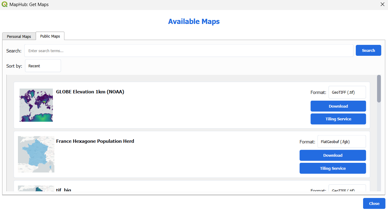
You can manage the download, upload, and synchronization between local and remote files trough MapHub’s API, CLI, or even directly inside QGIS thank to our plugin and it’s user friendly UI.
Datavisualization
Visualize your datasets in the browser, and make it directly accessible to your clients
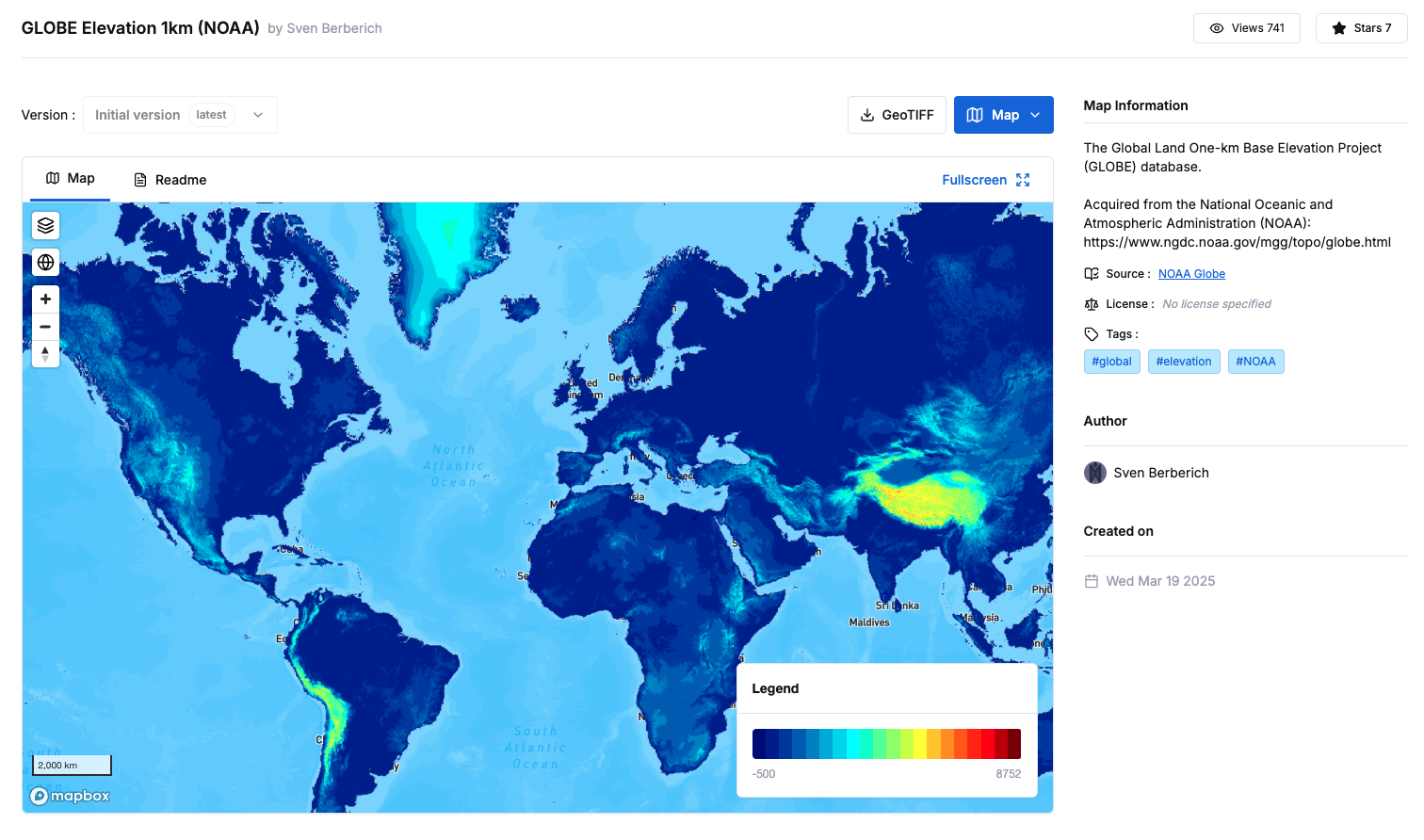
MapHub web platform enables you to quickly access any of your dataset, and visualize it on an interactive map. This make it easy for non-specialists to directly access data.
MapHub also comes with an Style editor powered by kepler.gl. It enables you to create beautiful visualization you can export or directly share with your clients.
You can also published maps to make them available to the community, and promote your expertise.
Seamlessly integrate with QGIS
Access your datasets on the cloud directly into QGIS thanks to our plugin
Seamless Integration
Access remote data directly within QGIS
Streamlined workflows
Download, modify, and synchronize data without leaving QGIS
User friendly UI
Manage everything through simple and clear interfaces
Pricing Plans
Team
Collaborate with your team, host and share geospatial data.
Benefits
- Collaborate with your team
- QGIS integration
- Advanced version control
- Host any geospatial format
- Visualise and share with clients
Features
- • 50 GB per seat
- • Unlimited maps
- • Premium support
Enterprise
For organisations needing advanced geospatial cloudBenefits
- SSO / SAML
- Dedicated Company Hub
- Interface with other Cloud storage solutions
- On premises options
- Support (24h response time)
Features
- • Start at 1 TB
- • Unlimited users
- • Large file support
Interested but still not sure ?
Contact us for a demo !
Subscribe to our newsletter !
Receive our last product updates and community news directly in your inbox.